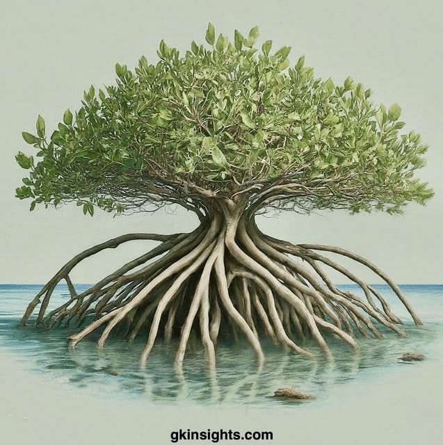
What are Mangroves and Characteristics of Mangroves
Mangroves are tropical trees that grow in swampy areas, along sea coasts etc. and have tangled roots above ground.
Major Characteristics of Mangroves:
– Halophytics: Highly tolerant to salinity
– Pneumatophores: Have roots outside
– Vivipary: Growth of new plant on tree
Map of Mangrove Forest Sites in India
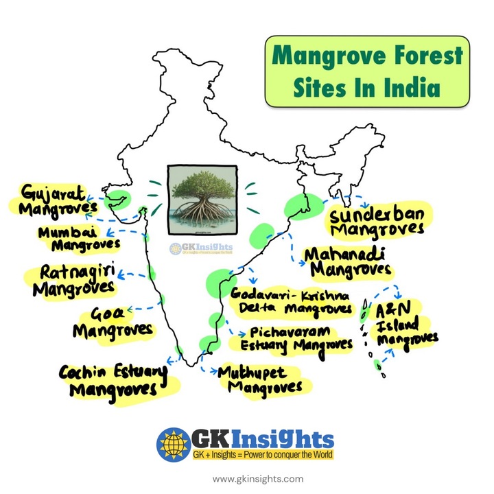
Mangrove Forest Sites in India
| S. No. | Mangrove Area | State/UT |
|---|---|---|
| 1 | Sundarbans | West Bengal |
| 2 | Bhitarkanika | Odisha |
| 3 | Gulf of Kutch | Gujarat |
| 4 | Andaman and Nicobar Islands | A&N |
| 5 | Pichavaram | Tamil Nadu |
| 6 | Krishna Wildlife Sanctuary | Andhra Pradesh |
| 7 | Vembanad-Kol Wetland | Kerala |
| 8 | Mahanadi Delta | Odisha |
| 9 | Godavari Delta | Andhra Pradesh |
| 10 | Netravali Wildlife Sanctuary | Goa |
| 11 | Muthupet | Tamil Nadu |
| 12 | Coringa Wildlife Sanctuary | Andhra Pradesh |
| 13 | Chorao Island | Goa |
| 14 | Ratnagiri | Maharashtra |
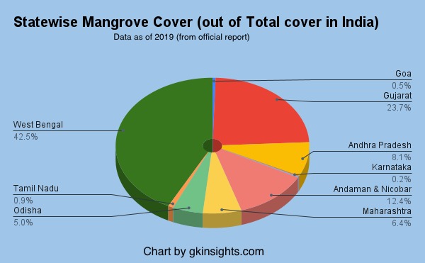
Mangrove Cover in India
- Predominantly in West Bengal, contributing to 42.45% of the total.
- Gujarat has 23.66% and A&N Islands have 12.39% of the total mangrove cover in India
- Mangrove cover in India is 4,975 sq km which is 0.15% India’s total area
Importance of Mangroves
- Mangroves safeguard coasts from waves, tsunamis, and erosion.
- Root system slows water, trapping sediment and pollutants.
- Fosters biodiversity by serving as breeding grounds for marine life.
- Supports livelihoods through honey, tannins, wax, and fishing.
- Essential carbon sinks for environmental balance.
Also Check:
– Rivers of India – Coloured Map & List: Easy to Remember
– 6 Soil Types in India: Map, Details Simplified with Mindmap
– Mountains, Ranges, Hills of India: Coloured Map
– [External] Mangrove Cover: 2019 Assessment
– Natural Vegetation
– 55 Tiger Reserves in India – Map & List
Knowledgeable and easy to remember.Thank you Waiting for next article.